About the photographer
Ben Sarao is the Executive Director of Primary Image. He works on long term documentary projects. His photographic documentaries include: The New Frontier Revisited, America's Early Space program, exhibited at NASA Headquarters; Eternal Garden of the Villa Borghese, made with the support go the Gli Amici d'Villa Borghese, City of Rome, as well as, The American Academy in Rome as a Visiting Artist; and, Shared Tragedy, a documentary on the effects of toxins in the environment that are causing birth defects worldwide. In July 2021, the entire United Nations delegation received digital copies of Shared Tragedy. The book is in three languages and it is available internationally online for free at: sharedtragedy.com. During the ongoing Covid pandemic, Ben's planned documentary in 3D of the Parthenon on the Athenian Acropolis, Greece, was cancelled. Instead, He is traveling "off-the-grid" to make panoramic photographs of the American landscape.
Editors note: To best appreciate these images, open the image in a separate window or tab.
Browse photos
- Previous photographer Tierney Plumb
- Next photographer Christine Schiffner
Ben Sarao: Electronic images
Praying Hands, Superstition Mountain, Arizona, 2020.
Located to the east of Phoenix, Superstition Mountain is part of a range mountains that boarder the Mesa valley
in Arizona.
Panoramic photograph from the ongoing documentary series, "Off-the-Grid during the Pandemic".
Traveling the paths less often taken. The Superstition Mountains are known as Wi:kchsawa by native Apaches They
believed that there is a hole within the mountains leading into a underworld and the winds from within cause the
regional monsoons. Dramatic skies near the mountains often predict wind storms. The "Praying Hands" are
part of the Slot Rock formation to the north side of the mountain.
Fallen Tree Root, Three Rivers, California, 2021
Large tree root along the roadside in Sequoia National Park
Panoramic photograph from the ongoing documentary series, "Off-the-Grid during the Pandemic". After
spending the night camping at Potwisha, the road through the park leads to a series of monumental Sequoia trees.
This fallen Sequoia tree is alongside the park road that was made in the 1930's as part of the tourist
attractions.
Sand, Dune City, Oregon, 2021
Parking area of the Dune National Recreation Center, Dune City, Oregon.
Panoramic photograph from the ongoing documentary series, "Off-the-Grid during the Pandemic". The
Waxmyrtle campsites in the Dunes National Recreational Center are near the Pacific Ocean. From the top of the sand
dunes off the Oregon Coast, the cars below are surrounded by sand.
Seal Rock, Oregon Coastline, 2021
Near Newport, Oregon, Seal Rock is a large rock formation jutting out into the Pacific Ocean.
Panoramic photograph from the ongoing documentary series, "Off-the-Grid during the Pandemic". Seal
Rock is a habitat for marine life. Most photographs of Seal Rock are made from the edge of ocean. This image is
made from the end of a small trail behind the Seal Rock formation that has a deadly drop into the crevice between
the rocks at low tide.
Print photos
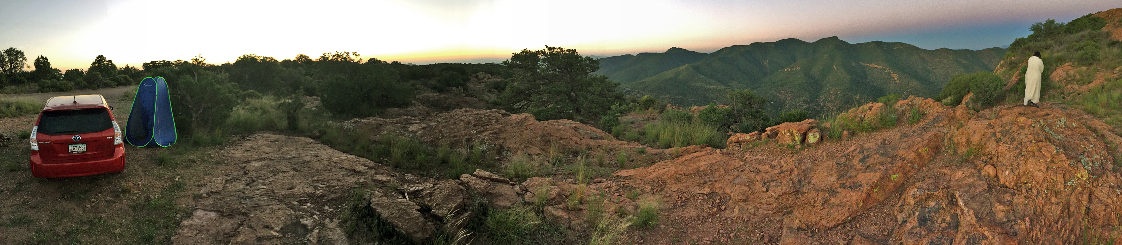
Sunrise, Abrigo Canyon Overlook, 2020
Panoramic photograph from the top the Abrigo Canyon, near Bisbee, Arizona, there are several small campsites
without any amenities... just specular sunrises.
From the ongoing documentary series, Off-the-Grid during the pandemic. Located on Cochise County, Arizona,
Abrigo Canyon is very remote and accessible by a narrow one lane dirt road. Red Mountain is to the northwest side
of the canyon. The sunrises are spectacular with a vista as far as the eye can see.
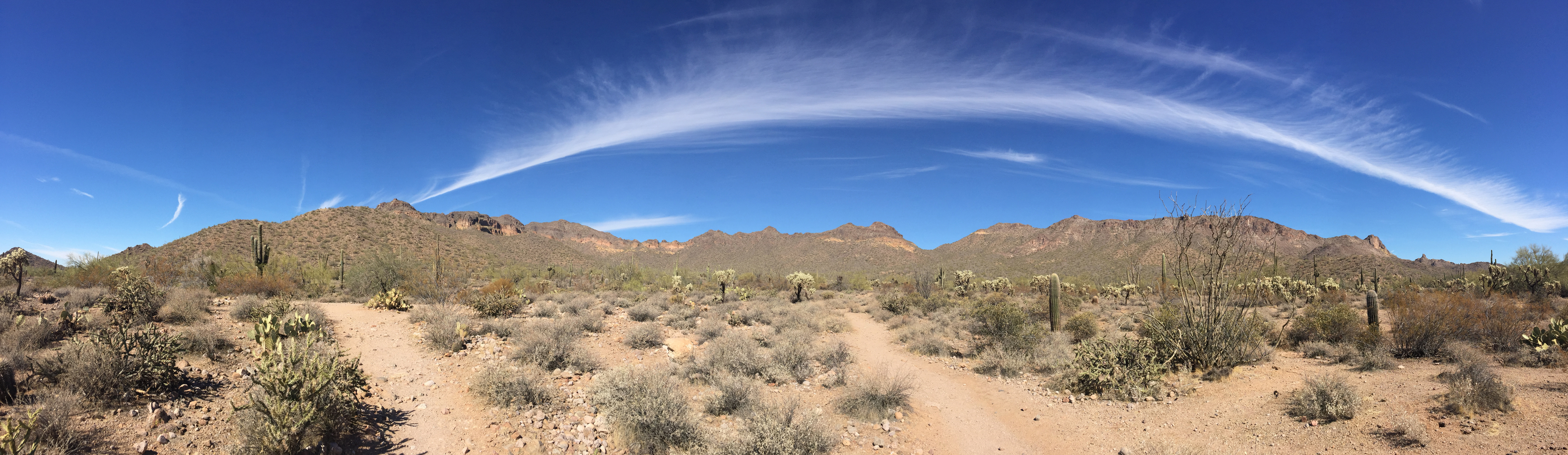
Cirrus Cloud, Crimson Trailhead, 2020
Panoramic photograph of cirrus clouds stretching for miles. At altitudes from 5,000 metro to 13,700 meters,
Cirrus clouds predict clear weather that is good for hiking in the outback countryside.
From the ongoing documentary series, Off-theGrid during the Pandemic.The Usery Mountains in Maricopa County,
Arizona, are part of the Salt River Valley Settlement from 1867. Ancient tribes once irrigated the land with a
series of canals from the river. The expanse to the south of the Usery Mountain is where the Crimson Trailhead
begins. The sky is crystal blue and occasionally a cirrus cloud sneaks over the mountain.